

Zdjęcia na tkaninie autora Dominic Gentilcore
FILTRUJ WYNIKI
Orientacja obrazów: wszystkie
pozioma
pionowa
kwadratowa
Rodzaj obrazów: wszystkie
zdjęcie
ilustracja
wektor
Zastosuj
#656863850
 Fish Ladder at John Day Dam provides passage upstream for Salmon, Steelhead, Sturgeon, and Eel in...
#311770520
 USA, Nevada, Clark County, Las Vegas. A scenic view of the famous Vegas skyline of casinos, hotels,...
#209421757
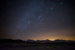 Milky Way Over Sierra Eastside
#224767657
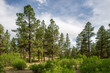 Open, park like Ponderosa Pine Woodland, San Juan National Forest, Colorado
#251487264
 Panoramic Las Vegas Strip City Skyline of Hotels, Casinos, and Entertainment Centers
#251484489
 Cainos for Gambling on the Las Vegas Strip Skyline Panorama, Nevada, United States
#317400224
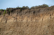 USA, California, San Mateo County, Half Moon Bay. An exposed cross section of Wastonville soil...
#515542221
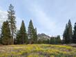 Black Butte seen from Weed, California. In the foreground are yellow wildflowers that are noxious...
#323081593
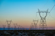 USA, Nevada, Clark County, Eldorado Valley, Boulder City. The silhouette of a power transmission...
#323066203
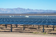 A field of solar panels in a rapidly growing solar energy development corridor in the Mojave Desert.
#479117514
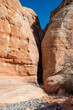 A slot canyon along the White Dome hiking trail at Valley of Fire State Park outside Las Vegas,...
#313151863
 USA, Nevada, Clark County, Las Vegas. A bright high key panorama of the Vegas skyline along the...
#317372921
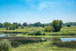
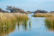 USA, California, Kern County, Kern National Wildlife Refuge. Duck habitat between reeds at this...
#599759128
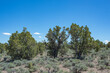 A Pinyon juniper woodland encroaching into sagebrush shrubland in White Pine County, Nevada. Young...
#603184384
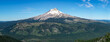 A view of the east face of Mount Hood (11,240 ft). This picturesque panormana is seen from the top...
#599756988
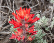 A close up macro of the red flower of Desert Paintbrush (Castilleja chromosa) also known as Indian...
#251485251
 Las Vegas Strip Casinos and Hotels Skyline Panorama
#311659938
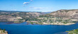
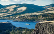
 USA, Nevada, Washoe County, Incline Village. The blue expanse of Lake Tahoe with granite boulders...
#319057090
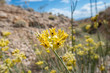 USA, Nevada, Clark County, Las Vegas Valley. The yellow flowers of Rush milkweed (Asclepias...
#407950846
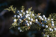 Utah juniper (Juniperus osteosperma) berries on branch. These blue-green glaucous fruits can be used...
#402738077
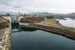 The Dalles Lock and Dam built by the U.S. Army Corps of Engineers in the Columbia River Gorge...
#285532272
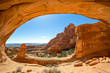 USA, Utah, Grand County, Arches National Park, Klondike Bluffs. A scenic view with Tower Arch...
#421981969
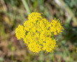 Macro closeup of Grays Lomatium (Lomatium grayi) is a large yellow wildflower in the carrot family....
#329920522
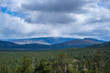 Dark clouds and a storm over Dog Valley filled with dense Jeffrey Pine tree (Pinus jeffreyi) forests...
#361204882
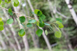 The green leaves of quaking aspen (Populus tremuloides) in the willow family (Salicaceae)
#416455206
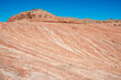 Fire Wave at Valley of Fire is a banded red and white sandstone formation a short hike away from...
#476350305
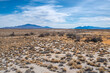 Salt Desert Scrub vegetation community at Ash Meadows National Wildlife Refuge in Nye County,...
#279265328
 USA, California, Sutter County, Woodland, Fremont Weir State Wildlife Area. A flock of cliff...
#657440086
 Panorama of Lyle Washington on the north side of the Columbia River Gorge. View from Tom McCall...
#657439884
 A barge filled with wheat for animal feed being pushed by a tugboat upstream in the Columbia River...
#656863952
 A view across the deck on top of John Day Lock and Dam hydroelectric facility on the Columbia River...
#656863929
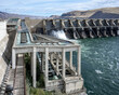
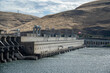 The John Day Dam powerhouse contains 16 turbines with a total electric generation capactiy of 2,160...
dodaj do ulubionych